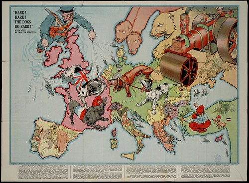
 Propaganda maps are created by a country or a group people trying to emphasize or de- emphasize certain regions. They can be satirical as shown in the map above, in which the mapmaker was attempting to make a point about Europe. They usually do not show factual representations of areas.
 http://farm4.static.flickr.com/3281/2722416468_1aebcdebb2.jpg


